Figures
0.1Map of the Arctic showing winter quarters of the maritime search expeditions and Indigenous communities in areas closest to expedition routes and winter quarters, 1848–59. Map by author.
0.2Samuel Gurney Cresswell, Critical Position of H.M.S. Investigator on the North Coast of Baring Island, August 20th 1851, 1854. Lithograph, 44.3 × 61.2 cm. Courtesy of Toronto Public Library.
1.1William Henry Browne, Rough Sketch Moored to an Iceberg, 1848. Crayon, 10.2 × 18.8 cm. Scott Polar Research Institute, University of Cambridge, with permission.
1.2William Henry Browne, Cape Walker Encampment, 1851. Watercolour, 23 × 42.5 cm. Scott Polar Research Institute, University of Cambridge, with permission.
1.3William T. Domville, Esquimaux Dance aboard Resolute, 1852. Pencil and watercolour, 12.2 × 17.5 cm. © National Maritime Museum, Greenwich, London.
1.4Robert Dawes Aldrich, Paraselene, 1850–1. Watercolour, 17.7 × 25.5 cm. © National Maritime Museum, Greenwich, London.
1.5William T. Mumford, The First View of the Coast Greenland 21.5.52, 1852. Pencil, 6.7 × 22.7 cm. Library and Archives Canada. Photo by author.
1.6William Blakey, An Incident in the Search for Sir John Franklin, 4 June 1854. Graphite and pastel, 6.4 × 10.3 cm (excluding frames). © National Maritime Museum, Greenwich, London.
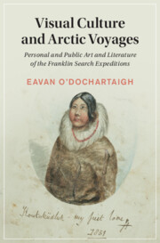
1.7Edward Adams, Koutoküdluk – My First Love, 1851. Watercolour, 18.5 × 13.6 cm. Scott Polar Research Institute, University of Cambridge, with permission.
1.8[Unknown Artist], North Star Mount in Wolstenholme Sound, SE. 1.8 miles: land of a brownish purplish tinge, August 15th 1850, 1850. Pencil and watercolour, 14 × 22.4 cm. National Library of Australia.
2.1Walter William May and Sherard Osborn, title page for the first issue of the ‘Queen’s Illuminated Magazine and North Cornwall Gazette’, November 1852. Pen and ink; watercolour, 34 × 28 cm. © British Library Board, London / Bridgeman Images.
2.2Walter William May, Monday Evening the 16th August 1852, 1852. Watercolour, 13.8 × 22.5 cm. ‘Queen’s Illuminated Magazine and North Cornwall Gazette’. © British Library Board, London / Bridgeman Images.
2.3Walter William May, Scene from The Rival Lovers, 1853. Pen and ink, 10.7 × 20 cm. ‘Queen’s Illuminated Magazine and North Cornwall Gazette’. © British Library Board, London / Bridgeman Images.
2.4Walter William May, Figure in Sealskins, 1853. Watercolour, 5 × 6 cm. ‘Queen’s Illuminated Magazine and North Cornwall Gazette’. © British Library Board, London / Bridgeman Images.
2.5Walter William May, The Defeat of Zero!, 1852. Pen and ink, 4.9 × 11.5 cm. ‘Queen’s Illuminated Magazine and North Cornwall Gazette’. © British Library Board, London / Bridgeman Images.
3.1Main locations of published narratives, 1850–60, from the search and supply expeditions. (Locations refer to areas in which ships spent most of their time.) Map by author.
3.2William Parker Snow, The ‘Prince Albert’ Surrounded by Icebergs, Voyage of the Prince Albert, 1851. Colour lithograph, 12.5 × 20 cm. Frontispiece of Snow, Voyage of the Prince Albert in Search of Sir John Franklin: A Narrative of Every-Day Life in the Arctic Seas (London: Longman, Brown, Green, and Longmans, 1851). Courtesy of Toronto Public Library.
3.3Peter C. Sutherland, A Group of Thirteen of the Flowers most Commonly Found around Assistance Bay, 1852. Colour lithograph, 17.8 × 11.6 cm. Plate 4, vol. 2 of Sutherland, Journal of a Voyage in Baffin’s Bay and Barrow Straits … in Search of the Missing Crews of H.M. Ships Erebus and Terror, 2 vols. (London: Longman, Brown, Green, and Longmans, 1852). Courtesy of Toronto Public Library.
3.4James Hamilton, after Elisha Kent Kane, Beechey Island – Franklin’s First Winter Quarters, 1854. Mezzotint, 10.4 × 16.2 cm. Plate 4 of Kane, The U.S. Grinnell Expedition in Search of Sir John Franklin. A Personal Narrative (New York: Harper & Brothers, 1854). Courtesy of Smithsonian Libraries and Archives / Biodiversity Heritage Library. Public Domain.
4.1Page from Burford’s booklet (1850), showing the visual layout and key to Summer and Winter Views of the Polar Regions. Engraving, 26 × 42.7 cm. Courtesy of Toronto Public Library.
4.2Diagram showing the evolution of Valley of the Glaciers, Greenland through multiple productions, 1848–50.
4.3William Henry Browne, Valley of the Glaciers, Greenland, 1848. Watercolour, 8.3 × 30.5 cm. © National Maritime Museum, Greenwich, London.
4.4Detail from William Henry Browne, Great Glacier, Near Uppernavik, 1850. Chromolithograph, 14.5 × 24 cm. Royal Collection Trust / © Her Majesty Queen Elizabeth II 2021.
4.5Diagram showing the evolution of Winter View, through multiple productions.
4.6William Henry Browne, The Expedition Housed in for the Winter, 17 November 1849. Engraving, 9.5 × 14.5 cm. © Illustrated London News / Mary Evans Picture Library.
4.7William Henry Browne, Noon in Mid-Winter, 1850. Chromolithograph, 16 × 23.5 cm. Royal Collection Trust / © Her Majesty Queen Elizabeth II 2021.
4.8Burford’s Panorama of the Polar Regions – the ‘Investigator’ Snow-walled in for the Winter, 23 February 1850. Engraving, 17 × 27 cm. © Illustrated London News / Mary Evans Picture Library.
5.1William Henry Browne, The Bivouac, Cape Seppings, Leopold Island, 1850. Lithograph, 24.5 × 17 cm. Royal Collection Trust / © Her Majesty Queen Elizabeth II 2021.
5.2William Henry Browne, Prince Regent’s Inlet, 1850. Lithograph, 24.5 × 17 cm. Royal Collection Trust / © Her Majesty Queen Elizabeth II 2021.
5.3William Henry Browne, Coast of N. Somerset – Regent’s Inlet, near Cape Leopold, 1849. Watercolour, 20.5 × 34.5 cm. Scott Polar Research Institute, University of Cambridge, with permission.
5.4William Henry Browne, Ravine near Port Leopold, 1850. Lithograph, 12 × 17.5 cm. Royal Collection Trust / © Her Majesty Queen Elizabeth II 2021.
5.5Samuel Gurney Cresswell, Brown’s Island, Coast of America, August 1850. Watercolour, 18.2 × 25.5 cm. © Norfolk Record Office, Norwich.
5.6Samuel Gurney Cresswell, H.M.S. Investigator in the Pack. October 8th 1850, 1854. Lithograph, 44.3 × 61.2 cm. Courtesy of Toronto Public Library.
5.7Samuel Gurney Cresswell, Critical Position of ‘The Investigator’, at Ballast Beach, Baring Island, 29 October 1853. Engraving, 11 × 15.5 cm. © Illustrated London News / Mary Evans Picture Library.
5.8Detail from Walter William May, Loss of the McLellan, 1852. Watercolour; pen and ink (top). Detail from Walter William May, Cape Lady Franklin, 1852/4. Graphite (bottom). © National Maritime Museum, Greenwich, London.

