Skip to main content Accessibility help
×
Hostname: page-component-745bb68f8f-g4j75 Total loading time: 0 Render date: 2025-01-22T20:47:50.612Z Has data issue: false hasContentIssue false

References

Published online by Cambridge University Press:  20 May 2020
George Grekousis
Affiliation:
Sun Yat-Sen University (SYSU), China
Get access

Summary

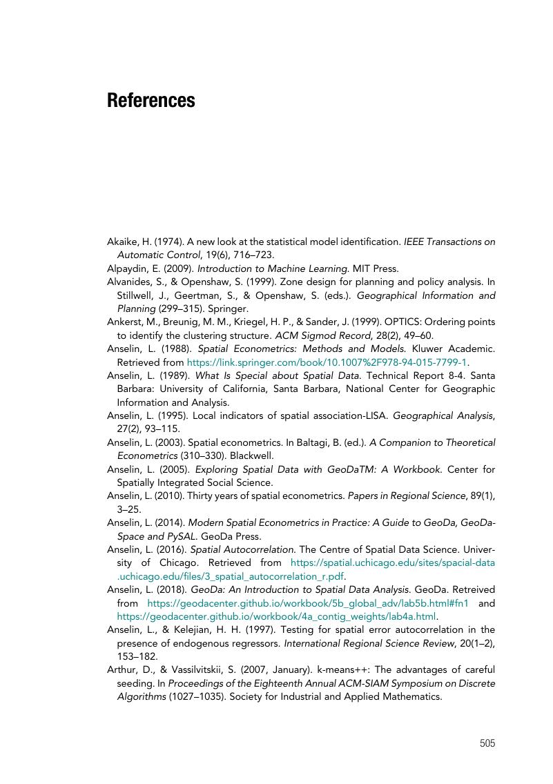
Image of the first page of this content. For PDF version, please use the ‘Save PDF’ preceeding this image.'
Type
Chapter
Information
Spatial Analysis Methods and Practice
Describe – Explore – Explain through GIS
, pp. 505 - 512
Publisher: Cambridge University Press
Print publication year: 2020

Access options

Get access to the full version of this content by using one of the access options below. (Log in options will check for institutional or personal access. Content may require purchase if you do not have access.)

References

Akaike, H. (1974). A new look at the statistical model identificationIEEE Transactions on Automatic Control19(6), 716723.Google Scholar
Alpaydin, E. (2009). Introduction to Machine Learning. MIT Press.Google Scholar
Alvanides, S., & Openshaw, S. (1999). Zone design for planning and policy analysis. In Stillwell, J., Geertman, S., & Openshaw, S. (eds.). Geographical Information and Planning (299315). Springer.Google Scholar
Ankerst, M., Breunig, M. M., Kriegel, H. P., & Sander, J. (1999). OPTICS: Ordering points to identify the clustering structure. ACM Sigmod Record28(2), 4960.Google Scholar
Anselin, L. (1988). Spatial Econometrics: Methods and Models. Kluwer Academic. Retrieved from https://link.springer.com/book/10.1007%2F978-94-015-7799-1.Google Scholar
Anselin, L. (1989). What Is Special about Spatial Data. Technical Report 8-4. Santa Barbara: University of California, Santa Barbara, National Center for Geographic Information and Analysis.Google Scholar
Anselin, L. (1995). Local indicators of spatial association-LISA. Geographical Analysis, 27(2), 93115.CrossRefGoogle Scholar
Anselin, L. (2003). Spatial econometrics. In Baltagi, B. (ed.). A Companion to Theoretical Econometrics (310330). Blackwell.Google Scholar
Anselin, L. (2005). Exploring Spatial Data with GeoDaTM: A Workbook. Center for Spatially Integrated Social Science.Google Scholar
Anselin, L. (2010). Thirty years of spatial econometricsPapers in Regional Science89(1), 325.CrossRefGoogle Scholar
Anselin, L. (2014). Modern Spatial Econometrics in Practice: A Guide to GeoDa, GeoDaSpace and PySAL. GeoDa Press.Google Scholar
Anselin, L. (2016). Spatial Autocorrelation. The Centre of Spatial Data Science. University of Chicago. Retrieved from https://spatial.uchicago.edu/sites/spacial-data.uchicago.edu/files/3_spatial_autocorrelation_r.pdf.Google Scholar
Anselin, L., & Kelejian, H. H. (1997). Testing for spatial error autocorrelation in the presence of endogenous regressorsInternational Regional Science Review20(1–2), 153182.CrossRefGoogle Scholar
Arthur, D., & Vassilvitskii, S. (2007, January). k-means++: The advantages of careful seeding. In Proceedings of the Eighteenth Annual ACM-SIAM Symposium on Discrete Algorithms (1027–1035). Society for Industrial and Applied Mathematics.Google Scholar
Assunção, R. M., Neves, M. C., Câmara, G., & da Costa Freitas, C. (2006). Efficient regionalization techniques for socio‐economic geographical units using minimum spanning trees. International Journal of Geographical Information Science, 20(7), 797811.Google Scholar
Bailey, T. C., & Gatrell, A. C. (1995). Interactive Spatial Data Analysis (Vol. 413). Longman Scientific & Technical.Google Scholar
Baller, R. D., Anselin, L., Messner, S. F., Deane, G., & Hawkins, D. F. (2001). Structural covariates of US county homicide rates: Incorporating spatial effects. Criminology, 39(3), 561588.Google Scholar
Belsley, D. A., Kuh, E., & Welsch, R. E. (1980). Regression Diagnostics: Identifying Influential Data and Sources of Collinearity. John Wiley & Sons. doi: 10.1002/0471725153.Google Scholar
Benjamini, Y. (2010). Discovering the false discovery rateJournal of the Royal Statistical Society: Series B (Statistical Methodology)72(4), 405416.Google Scholar
Benjamini, Y., & Hochberg, Y. (1995). Controlling the false discovery rate: A practical and powerful approach to multiple testingJournal of the Royal Statistical Society: Series B (Methodological), 57(1), 289300.Google Scholar
Bivand, R. S., Pebesma, E. J., Gomez-Rubio, V., & Pebesma, E. J. (2008). Applied Spatial Data Analysis with R (Vol. 747248717). Springer.Google Scholar
Blaikie, N. (2003). Analyzing Quantitative Data. SAGE Publications Ltd. doi: 10.4135/9781849208604.Google Scholar
Bonferroni, C. (1936). Teoria statistica delle classi e calcolo delle probabilitaPubblicazioni del R Istituto Superiore di Scienze Economiche e Commericiali di Firenze8, 362.Google Scholar
Breusch, T. S., & Pagan, A. R. (1979). A simple test for heteroscedasticity and random coefficient variation. Econometrica: Journal of the Econometric Society, 1287–1294.Google Scholar
Briggs, R. (2012). Lecture notes on spatial correlation and regression. Retrieved from www.utdallas.edu/~briggs/.Google Scholar
Brunsdon, C., Fotheringham, A. S., & Charlton, M. E. (1996). Geographically weighted regression: A method for exploring spatial nonstationarityGeographical Analysis28(4), 281298.Google Scholar
Brusco, M. J., & Cradit, J. D. (2001). A variable-selection heuristic for K-means clustering. Psychometrika, 66(2), 249270.CrossRefGoogle Scholar
Burt, J. E., Barber, G. M., & Rigby, D. L. (2009). Elementary Statistics for Geographers. Guilford Press.Google Scholar
Caldas de Castro, M., & Singer, B. H. (2006). Controlling the false discovery rate: A new application to account for multiple and dependent tests in local statistics of spatial associationGeographical Analysis38(2), 180208.Google Scholar
Caliński, T., & Harabasz, J. (1974). A dendrite method for cluster analysis. Communications in Statistics – Theory and Methods, 3(1), 127.Google Scholar
Campello, R. J., Moulavi, D., Zimek, A., & Sander, J. (2015). Hierarchical density estimates for data clustering, visualization, and outlier detection. ACM Transactions on Knowledge Discovery from Data (TKDD), 10(1), 5.CrossRefGoogle Scholar
Cangelosi, R., & Goriely, A. (2007). Component retention in principal component analysis with application to cDNA microarray data. Biology Direct, 2(1), 2.Google Scholar
Chambers, J. M., Cleveland, W. S., Kleiner, B., & Tukey, P. A. (1983). Comparing data distributions. In Graphical Methods for Data Analysis (4773). Bell Laboratories.Google Scholar
Charlton, M., Brunsdon, C., Demsar, U., Harris, P., & Fotheringham, S. (2010). Principal components analysis: From global to local. In 13th AGILE International Conference on Geographic Information Science, Guimaraes, Portugal.Google Scholar
Clark, P. J., & Evans, F. C. (1954). Distance to nearest neighbor as a measure of spatial relationships in populations. Ecology, 35(4), 445453.CrossRefGoogle Scholar
Dall’erba, S. (2009). Exploratory spatial data analysis. In Kitchin, R., & Thrift, N. (eds.). International Encyclopedia of Human Geography (Vol. 3) (683690). Elsevier.CrossRefGoogle Scholar
Darmofal, D. (2015). Spatial Analysis for the Social Sciences (Analytical Methods for Social Research). Cambridge University Press. doi: 10.1017/CBO9781139051293.CrossRefGoogle Scholar
Demšar, U., Harris, P., Brunsdon, C., Fotheringham, A. S., & McLoone, S. (2013). Principal component analysis on spatial data: An overview. Annals of the Association of American Geographers, 103(1), 106128.Google Scholar
de Smith, M. J. (2018). Statistical Analysis Handbook: A Comprehensive Handbook of Statistical Concepts, Techniques and Software Tools. Retrieved from www.statsref.com/HTML/index.html.Google Scholar
de Smith, M. J., Goodchild, M. F., & Longley, P. (2018). Geospatial Analysis: A Comprehensive Guide to Principles, Techniques and Software Tools (6th edn.). Retrieved from www.spatialanalysisonline.com.Google Scholar
de Vaus, D. (2002). Analyzing Social Science Data: 50 Key Problems in Data Analysis. Sage.Google Scholar
Duque, J. C., Ramos, R., & Suriñach, J. (2007). Supervised regionalization methods: A survey. International Regional Science Review, 30(3), 195220.Google Scholar
Ester, M., Kriegel, H. P., Sander, J., & Xu, X. (1996). A density-based algorithm for discovering clusters in large spatial databases with noise. Proceedings of Knowledge Discovery and Data Mining, 96(34), 226231.Google Scholar
ESRI. (2017). How emerging hot spot analysis works. ESRI. Retrieved from http://pro.arcgis.com/en/pro-app/tool-reference/space-time-pattern-mining/learnmoreemerging.htm.Google Scholar
Fischer, M. M., & Getis, A. (eds.). (2010). Handbook of Applied Spatial Analysis: Software Tools, Methods and Applications. Springer Science & Business Media.CrossRefGoogle Scholar
Fotheringham, S., Brunsdon, C., & Charlton, M. (2000). Quantitative Geography: Perspectives on Spatial Data Analysis. Sage.Google Scholar
Fotheringham, S., Brunsdon, C., & Charlton, M. (2002). Geographically Weighted Regression: The Analysis of Spatially Varying Relationships. Wiley.Google Scholar
Gangodagamage, C., Zhou, X., & Lin, H. (2008). Autocorrelation, spatial. In Shekhar, S., & Xiong, H. (eds.). Encyclopedia of GIS. Springer Science & Business Media.Google Scholar
Gatrell, A. C., Bailey, T. C., Diggle, P. J., & Rowlingson, B. S. (1996). Spatial point pattern analysis and its application in geographical epidemiology. Transactions of the Institute of British Geographers, 256–274.Google Scholar
Geary, R. C. (1954). The contiguity ratio and statistical mapping. The Incorporated Statistician, 5, 115145.Google Scholar
Getis, A. (1990). Screening for spatial dependence in regression analysis. Papers in Regional Science, 69(1), 6981.Google Scholar
Getis, A. (1995). Spatial filtering in a regression framework: Examples using data on urban crime, regional inequality, and government expenditures. In Anselin, L., & Florax, R. J. G. M. (eds.). New Directions in Spatial Econometrics: Advances in Spatial Science. Springer.Google Scholar
Getis, A., & Griffith, D. A. (2002). Comparative spatial filtering in regression analysisGeographical Analysis34(2), 130140.Google Scholar
Getis, A., & Ord, J. K. (1992). The analysis of spatial association by use of distance statistics. Geographical Analysis, 24(3), 189206.CrossRefGoogle Scholar
Gnanadesikan, R., Kettenring, J. R., & Tsao, S. L. (1995). Weighting and selection of variables for cluster analysis. Journal of Classification, 12(1), 113136.Google Scholar
Goodchild, M. (2008). Data analysis, spatial. In Shekhar, S., & Xiong, H., (eds.). Encyclopedia of GIS. Springer Science & Business Media.Google Scholar
Goulard, M., Laurent, T., & Thomas-Agnan, C. (2017). About predictions in spatial autoregressive models: Optimal and almost optimal strategiesSpatial Economic Analysis12(2–3), 304325.Google Scholar
Grekousis, G. (2013a). Giving fuzziness to spatial clusters: A new index for choosing the optimal number of clusters. International Journal on Artificial Intelligence Tools, 22(03), 1350009.Google Scholar
Grekousis, G. (2018). Further widening or bridging the gap? A cross-regional study of unemployment across the EU Amid Economic CrisisSustainability10(6), 1702.Google Scholar
Grekousis, G. (2019). Artificial neural networks and deep learning in urban geography: A systematic review and meta-analysis. Computers, Environment and Urban Systems, 74, 244256. https://doi.org/10.1016/j.compenvurbsys.2018.10.008.CrossRefGoogle Scholar
Grekousis, G., & Fotis, Y. N. (2012). A fuzzy index for detecting spatiotemporal outliersGeoinformatica16(3), 597619.Google Scholar
Grekousis, G., & Gialis, S. (2018). More flexible yet less developed? Spatio-temporal analysis of labor flexibilization and gross domestic product in crisis-hit European Union regions. Social Indicators Research, 1–20.Google Scholar
Grekousis, G., & Hatzichristos, T. (2013). Fuzzy clustering analysis in geomarketing researchEnvironment and Planning B: Planning and Design40(1), 95116.Google Scholar
Grekousis, G., & Liu, Y. (2019). Where will the next emergency event occur? Predicting ambulance demand in emergency medical services using artificial intelligence. Computers, Environment and Urban Systems, 76, 110122. https://doi.org/10.1016/j.compenvurbsys.2019.04.006.Google Scholar
Grekousis, G., & Mountrakis, G. (2015). Sustainable development under population pressure: Lessons from developed land consumption in the conterminous USPloS One10(3), e0119675.CrossRefGoogle Scholar
Grekousis, G., & Photis, Y. N. (2014). Analyzing high-risk emergency areas with GIS and neural networks: The case of Athens, GreeceThe Professional Geographer66(1), 124137.Google Scholar
Grekousis, G., & Thomas, H. (2012). Comparison of two fuzzy algorithms in geodemographic segmentation analysis: The Fuzzy C-Means and Gustafson–Kessel methods. Applied Geography, 34, 125136.Google Scholar
Grekousis, G., Kavouras, M., & Mountrakis, G. (2015a). Land cover dynamics and accounts for European Union 2001–2011. In Third International Conference on Remote Sensing and Geoinformation of the Environment (RSCy2015) (Vol. 9535, p. 953507). International Society for Optics and Photonics.Google Scholar
Grekousis, G., Manetos, P., & Photis, Y. N. (2013). Modeling urban evolution using neural networks, fuzzy logic and GIS: The case of the Athens metropolitan areaCities30, 193203.Google Scholar
Grekousis, G., Mountrakis, G., & Kavouras, M. (2015b). An overview of 21 global and 43 regional land-cover mapping productsInternational Journal of Remote Sensing36(21), 53095335.Google Scholar
Grekousis, G., Mountrakis, G., & Kavouras, M. (2016). Linking MODIS-derived forest and cropland land cover 2011 estimations to socioeconomic and environmental indicators for the European Union’s 28 countriesGIScience & Remote Sensing53(1), 122146.Google Scholar
Griffith, D. A., & Amrhein, C. G. (1997). Multivariate Statistical Analysis for Geographers. Prentice Hall.Google Scholar
Guo, D. (2008). Regionalization with dynamically constrained agglomerative clustering and partitioning (REDCAP). International Journal of Geographical Information Science, 22(7), 801823.Google Scholar
Haining, P. R. (2010). The nature of georeferenced data. In Fischer, M., & Getis, A. (eds.). Handbook of Applied Spatial Analysis. Springer.Google Scholar
Halkidi, M., Batistakis, Y., & Vazirgiannis, M. (2001). On clustering validation techniquesJournal of Intelligent Information Systems17(2–3), 107145.Google Scholar
Hamilton, L. (2014). Introduction to Principal Component Analysis (PCA). Retrieved from www.lauradhamilton.com/introduction-to-principal-component-analysis-pca.Google Scholar
Harris, P., Brunsdon, C., & Charlton, M. (2011). Geographically weighted principal components analysis. International Journal of Geographical Information Science, 25(10), 17171736.Google Scholar
Illian, J., Penttinen, A., Stoyan, H., & Stoyan, D. (2008). Statistical Analysis and Modelling of Spatial Point Patterns (Vol. 70). John Wiley & Sons.Google Scholar
Jackson, J. E. (1991). A User’s Guide to Principal Components. John Wiley & Sons.Google Scholar
Jain, A. K., & Dubes, R. C. (1988). Algorithms for Clustering Data. Prentice-Hall.Google Scholar
Jiang, M. F., Tseng, S. S., & Su, C. M. (2001). Two-phase clustering process for outliers detection. Pattern Recognition Letters, 22(6–7), 691700.Google Scholar
Jolliffe, I. T. (2002). Principal Component Analysis. Springer Series in Statistics. Springer.Google Scholar
Kelejian, H. H., & Prucha, I. R. (2010). Specification and estimation of spatial autoregressive models with autoregressive and heteroskedastic disturbancesJournal of Econometrics157(1), 5367.Google Scholar
Kim, C. W., Phipps, T. T., & Anselin, L. (2003). Measuring the benefits of air quality improvement: A spatial hedonic approachJournal of Environmental Economics and Management45(1), 2439.CrossRefGoogle Scholar
Koenker, R., & Hallock, K. (2001). Quantile regression: An introduction. Journal of Economic Perspectives, 15(4), 4356.Google Scholar
Krivoruchko, K. (2011). Spatial Statistical Data Analysis for GIS UsersESRI Press.Google Scholar
Kulin, H. W., & Kuenne, R. E. (1962). An efficient algorithm for the numerical solution of the generalized Weber problem in spatial economics. Journal of Regional Science, 4(2), 2133.Google Scholar
Lacey, M. (1997). Multiple Linear Regression. Retrieved from www.stat.yale.edu/Courses/1997-98/101/linmult.htm.Google Scholar
Lee, J., & Wong, D. W. (2001). Statistical Analysis with ArcView GIS. John Wiley & Sons.Google Scholar
LeSage, J. P. (1998). Spatial Econometrics. Report retrieved from http://spatial-econometrics.com/html/wbook.pdf.Google Scholar
Linneman, T. J. (2011). Social Statistics: The Basics and Beyond. Routledge.Google Scholar
Longley, P. A., Goodchild, M. F., Maguire, D. J., & Rhind, D. W. (2011). Geographic Information Science and Systems (3rd edn.). John Wiley & Sons.Google Scholar
Liu, Y., Wang, R., Grekousis, G., Liu, Y., Yuan, Y., & Li, Z. (2019). Neighbourhood greenness and mental wellbeing in Guangzhou, China: What are the pathways? Landscape and Urban Planning, 190, 103603. https://doi.org/10.1016/j.landurbplan.2019.103602.Google Scholar
Lu, Y., & Thill, J. C. (2003). Assessing the cluster correspondence between paired point locations. Geographical Analysis, 35(4), 290309.Google Scholar
MacQueen, J. (1967). Some methods for classification and analysis of multivariate observations. Proceedings of the Fifth Berkeley Symposium on Mathematical Statistics and Probability, 1(14), 281297.Google Scholar
Mitchell, A. (2005). The ESRI Guide to GIS Analysis, Volume 2. ESRI Press.Google Scholar
Moran, P. A. P. (1950). Notes on continuous stochastic phenomena. Biometrika, 37, 1723.Google Scholar
Murray, A. T. (2010). Quantitative geographyJournal of Regional Science50(1), 143163.Google Scholar
Neyman, J. (1937). X: Outline of a theory of statistical estimation based on the classical theory of probabilityPhilosophical Transactions of the Royal Society of London. Series A, Mathematical and Physical Sciences236(767), 333380.Google Scholar
Newton, R. R., & Rudestam, K. E. (1999). Your Statistical Consultant: Answers to Your Data Analysis Questions. Sage.Google Scholar
Ogee, A., et al. (2013). Multiple regression analysis: Use adjusted R-squared and predicted R-squared to include the correct number of variables. Minitab. Retrieved from http://blog.minitab.com/blog/adventures-in-statistics-2/multiple-regession-analysis-use-adjusted-r-squared-and-predicted-r-squared-to-include-the-correct-number-of-variables.Google Scholar
Openshaw, S. (1977). A geographical solution to scale and aggregation problems in region-building, partitioning and spatial modelling. Transactions of the Institute of British Geographers, 459–472.Google Scholar
Ord, K. (1975). Estimation methods for models of spatial interactionJournal of the American Statistical Association70(349), 120126.Google Scholar
Ord, J. K., & Getis, A. (1995). Local spatial autocorrelation statistics: Distributional issues and an application. Geographical Analysis, 27(4), 286306.Google Scholar
O’Sullivan, D., & Unwin, D. (2003). Geographic Information Analysis. John Wiley & Sons.Google Scholar
O’Sullivan, D., & Unwin, D. (2010). Geographic Information Analysis (2nd edn.). John Wiley & Sons.Google Scholar
Oyana, T. J., & Margai, F. (2015). Spatial Analysis: Statistics, Visualization, and Computational Methods. CRC Press.CrossRefGoogle Scholar
Paez, A., & Scott, D. M. (2004). Spatial statistics for urban analysis: A review of techniques with examplesGeoJournal61(1), 5367.Google Scholar
Pallant, J. (2013). SPSS Survival Manual. McGraw-Hill Education (UK).Google Scholar
Peck, R., Olsen, C., & Devore, J. L. (2012). Introduction to Statistics and Data Analysis (4th edn.). Cengage Learning.Google Scholar
Pena, J. M., Lozano, J. A., & Larranaga, P. (1999). An empirical comparison of four initialization methods for the k-means algorithm. Pattern Recognition Letters, 20(10), 10271040.Google Scholar
Penn State University. (2018). STAT 505: Lesson 11; Principal Components Analysis (pca). Retrieved from https://onlinecourses.science.psu.edu/stat505/node/49/.Google Scholar
Photis, Y. N., & Grekousis, G. (2012). Locational planning for emergency management and response: An artificial intelligence approachInternational Journal of Sustainable Development and Planning7(3), 372384.Google Scholar
Rawlings, J. O., Pantula, S. G., & Dickey, D. A. (1998). Applied Regression Analysis: A Research Tool. Springer Science & Business Media.CrossRefGoogle Scholar
Ripley, B. D. (1976). The second-order analysis of stationary point processes. Journal of Applied Probability, 13(2), 255266.CrossRefGoogle Scholar
Rogerson, P. A. (2001). Statistical Methods for Geography. Sage.Google Scholar
Sander, J., Ester, M., Kriegel, H. P., & Xu, X. (1998). Density-based clustering in spatial databases: The algorithm gdbscan and its applicationsData Mining and Knowledge Discovery2(2), 169194. https://doi.org/10.1023/A:1009745219419.Google Scholar
Sankey, T. T. (2008). Statistical descriptions of spatial patterns. In Shekhar, S., & Xiong, H., (eds.). Encyclopedia of GIS (1135–1141). Springer Science & Business Media.Google Scholar
Schubert, E., Sander, J., Ester, M., Kriegel, H. P., & Xu, X. (2017). DBSCAN revisited, revisited: Why and how you should (still) use DBSCAN. ACM Transactions on Database Systems (TODS), 42(3), 19.Google Scholar
Schwarz, G. (1978). Estimating the dimension of a model. The Annals of Statistics, 6(2), 461464.Google Scholar
Scibila, B. (2017). Regression analysis: How to interpret S, the standard error of the regression. Minitab. Retrieved from http://blog.minitab.com/blog/adventures-in-statistics-2/regression-analysis-how-to-interpret-s-the-standard-error-of-the-regression.Google Scholar
Scott, L. M., & Janikas, M. V. (2010). Spatial statistics in ArcGIS. In Fischer, M. M., & Getis, A. (eds.).Handbook of Applied Spatial Analysis (2741). Springer.Google Scholar
Silverman, B. W. (1986). Density Estimation for Statistics and Data Analysis. Chapman and Hall.Google Scholar
Sokal, R. R., & Rohlf, F. J. (1962). The comparison of dendrograms by objective methods. Taxon, 33–40.Google Scholar
Stillwell, J., Geertman, S., & Openshaw, S. (eds.). (1999). Geographical Information and Planning: European Perspectives. Springer Science & Business Media.Google Scholar
Tabachnick, B. G., Fidell, L. S., & Ullman, J. B. (2012). Using Multivariate Statistics (6th edn.). Pearson.Google Scholar
Tobler, W. R. (1979). Cellular geography. In Gale, S., & Olsson, G. (eds.). Philosophy in Geography (379386). Springer.Google Scholar
Thayn, J. B., & Simanis, J. M. (2013). Accounting for spatial autocorrelation in linear regression models using spatial filtering with eigenvectors. Annals of the Association of American Geographers, 103(1), 4766.Google Scholar
Troy, A. (2008). Geodemographic segmentation. In Shekhar, S., & Xiong, H. (eds.). Encyclopedia of GIS (347355). Springer.Google Scholar
Tufte, E. R. (2001). The Visual Display of Quantitative Information (2nd edn.). Graphics Press.Google Scholar
Wang, F. (2014). Quantitative Methods and Socio-economic Applications in GIS. CRC Press.Google Scholar
Wang, R. et al. (2019). Perceptions of built environment and health outcomes for older Chinese in Beijing: A big data approach with street view images and deep learning technique. Computers, Environment and Urban Systems, 78. https://doi.org/10.1016/j.compenvurbsys.2019.101386.Google Scholar
Wheeler, D. C., & Páez, A. (2010). Geographically Weighted Regression. In Fischer, M., & Getis, A. (eds.). Handbook of Applied Spatial Analysis (461486). Springer.Google Scholar
White, H. (1980). A heteroskedasticity-consistent covariance matrix estimator and a direct test for heteroskedasticity. Econometrica: Journal of the Econometric Society, 817–838.Google Scholar
Yrigoyen, C. (2007). Session 7: Spatial Dependence Models: Estimation and Testing. Lecture notes. Retrieved from www.uam.es/personal_pdi/economicas/coro/docencia/doctorado/spateconUPC/Slides/Session7_SpatialDepModel_Slides.pdf.Google Scholar
Zhou, X., & Lin, H. (2008) In Geary’s, C. Shekhar, S., & Xiong, H. (eds.). Encyclopedia of GIS. Springer Science & Business Media.Google Scholar

Save book to Kindle

To save this book to your Kindle, first ensure [email protected] is added to your Approved Personal Document E-mail List under your Personal Document Settings on the Manage Your Content and Devices page of your Amazon account. Then enter the ‘name’ part of your Kindle email address below. Find out more about saving to your Kindle.

Note you can select to save to either the @free.kindle.com or @kindle.com variations. ‘@free.kindle.com’ emails are free but can only be saved to your device when it is connected to wi-fi. ‘@kindle.com’ emails can be delivered even when you are not connected to wi-fi, but note that service fees apply.

Find out more about the Kindle Personal Document Service.

  • References
  • George Grekousis
  • Book: Spatial Analysis Methods and Practice
  • Online publication: 20 May 2020
  • Chapter DOI: https://doi.org/10.1017/9781108614528.009
Available formats
×

Save book to Dropbox

To save content items to your account, please confirm that you agree to abide by our usage policies. If this is the first time you use this feature, you will be asked to authorise Cambridge Core to connect with your account. Find out more about saving content to Dropbox.

  • References
  • George Grekousis
  • Book: Spatial Analysis Methods and Practice
  • Online publication: 20 May 2020
  • Chapter DOI: https://doi.org/10.1017/9781108614528.009
Available formats
×

Save book to Google Drive

To save content items to your account, please confirm that you agree to abide by our usage policies. If this is the first time you use this feature, you will be asked to authorise Cambridge Core to connect with your account. Find out more about saving content to Google Drive.

  • References
  • George Grekousis
  • Book: Spatial Analysis Methods and Practice
  • Online publication: 20 May 2020
  • Chapter DOI: https://doi.org/10.1017/9781108614528.009
Available formats
×