Hostname: page-component-7bb8b95d7b-lvwk9 Total loading time: 0 Render date: 2024-09-18T07:35:59.506Z Has data issue: false hasContentIssue false

Exploration in Galatia cis Halym

Published online by Cambridge University Press:  23 December 2013

Extract

During the last eighteen years our knowledge of Asia Minor has advanced by leaps and bounds, but all parts of the country have not shared alike in the general progress. Galatia in particular—we are now speaking of the country on this side of the Halys—has received comparatively little attention from archaeological travellers. Humann and Domaszewski's journey in 1882 and some journeys made by Prof. Ramsay in the following year and by Dr. Körte in 1894 (in the vicinity of the Sangarios) constitute the whole contribution that has been made to the exploration of this region since the publication of M. Perrot's Exploration de la Galatie (1862). A good deal has been done in the meantime by geographers to improve the modern map of the northern frontiers, notably by W. von Diest, whose work is always as nearly a picture of the country as can be attained without a regular survey. That he may be able to continue it is the fervent wish of all who are interested in Asia Minor. But there are few points fixed with any certainty on the ancient map, and there are large districts which are either hardly known (like the country near the great Salt Lake) or have never been visited at all.

Type
Research Article
Copyright
Copyright © The Society for the Promotion of Hellenic Studies 1899

Access options

Get access to the full version of this content by using one of the access options below. (Log in options will check for institutional or personal access. Content may require purchase if you do not have access.)

References

page 52 note 1 These maps are based on Kiepert's large-scale map of Western Asia Minor and incorporate the results of journeys by M. Anton and other travellers. They are published in Petermann's Mittheilungen, Ergänzungsheft, no. 125. [Naturally, they are much less correct in districts which the travellers have not actually visited.]

page 52 note 3 The abbreviation CB. refers to Ramsay's, Cities and Bishoprics of Phrygia (Oxford, 1895 and 1897)Google Scholar. Inscriptions copied by myself are marked (A.), those copied by Mr. Crowfoot (C. ). A A. SS. = Acta Sanctorum. I am indebted to Prof. Ramsay for valuable criticisms and suggestions, and to the editors of the Journal for carefully revising the proof-sheets and making suggestions.

page 53 note 1 For the section between Angora and Par nasses, see vii. hel below.

page 53 note 2 ἡ δημοσία στράτα τοῦ βασιλικοῦ δρόμου in the Greek original (p. 363), which is published in Ἁγιολογικὰ, Μνημϵῖα, ἐκδιδόμϵνα ὑπὸ Θϵοφίλου Ἰωάννου (BENTEIA, 1884), pp. 361495Google Scholar. We refer to it as the ‘Life of St. Theodore (of Sykeon).’

page 53 note 3 Hogarth, , Modern and Ancient Roads, &c. (R.G.S. Suppl. Papers, vol. iii.) p. 45Google Scholarn., mentions that a stone now at Geuksun (Ko-kussos) has been conveyed fifteen miles, and ‘apparently one has been carried from the fifty-eighth station to Albistan, about twenty-five miles.’

page 53 note 4 The shifting of town-centres in modern times has, of course, caused some deviation from the ancient line, as will appear below.

page 54 note 1 Fractions of a Roman mile are counted as a whole mile, e.g. 13⅓ MP. as 14. We do not claim to estimate distances with the accuracy of a regular survey; but the calculations are for all practical purposes exact enough.

page 55 note 1 V.l. Grentius; so Garas Vicus for Carus Vicus, and Gratia for Cratia. In local Turkish pronunciation it is very difficult to distinguish initial k and g; ancient k has become g in Krateia-Gerede, Kadoi (accus. κάδουσ)-Gediz, &c.; so Girindos (in Murtad Ova) seems to be local pronunciation, as Mordtmann has it, while Kiepert writes Kirindos.

page 55 note 2 So von Diest proposes, Petermann, Mitthcil. Ergänzungsheft, no. 125, p. 59Google Scholar.

page 55 note 3 Op. cit. pp. 58–9.

page 55 note 4 On the west side.

page 55 note 5 J.H.S. x. (1889), p. 181.

page 56 note 1 Cf. Hamilton i. p. 368–9; Perrot, , Explora tion, p. 373Google Scholar.

page 56 note 2 Perrot, , Histoire de ľ Art, v. p. 162Google Scholar.

page 56 note 3 Von Diest wrongly takes them for steps, 6–8 Fuss breite Treppenstufen, &C.

page 56 note 4 There are certainly traces of excavation, and the present Vali Pasha is greatly interested in antiquities.

page 56 note 5 Cf., e.g., the necropolis of Gordion beside Pebi (Körte, , Ath. Mitth. 1897, p. 22Google Scholar).

page 56 note 6 It is not necessary to quote examples of this well-known fact (see J.H.S. 1898, p. 104 and n. 2): we shall come across instances in the sequel.

page 56 note 7 Karalar is, according to von Diest, 37½ km. or 23 Eng. miles from Angora, and Yassi-ören is the same. We have to remember that the Itineraries reckon the distances from city to city; and the sum of these separate distances is therefore often greater than the whole length of the road as reckoned on the milestones.

page 58 note 1 Cf. also Ainsworth, , Travels, p. 136Google Scholar. It is necessary to point out that the distances as shown on the maps are here too great, though it is beyond our power to correct them. Thus the distance between Angora and Ayash is, according to all accounts (including Sir C. Wilson's accurate reports), nine hours, which certainly cannot represent more than twentyeight miles. Everybody knows that the actual distance by road is greater, as a rule, than the same distance measured on the map, especially when a mountain like Ayash Bel has to be crossed; yet on the map we measure in a straight line thirty-four miles (55 kilometres)! Von Diest (or Dr. Hassenstein) seems to have been aware of this, for he says of the distance between Ayash and M̈lk (in Murtad Ova) Entfernung wahrscheinlich zu gross.

page 60 note 1 Istanos is likewise the modern name of Isinda. The natives distinctly pronounced it Istános, not Istanós. Ramsay, gives the derivation εἰς τὰ στένη (Amer. Jour. Arch. 1888, p. 155Google Scholar), which does not account for the last syllable.

page 60 note 2 Ainsworth, , Travels and Researches, p. 138Google Scholar; Wilson, , Handbook of As. Min. p. 5Google Scholar. We did not see it.

page 61 note 1 1,575 ft. above Ayash. according to my reading; while the chaussée rises to 1,500 ft. according to Sir C. Wilson (op. cit. p. 15). I travelled by the line of the old road, while Mr. C. followed the modern.

page 61 note 2 Il-khan = ‘;Tribe-chief.’ M. Perrot says that the plain n'a d'eau que pendant l'hiver. This can hardly be so; we were not actually down in the valley drained by the Ilkhan tchai, but below the village of Ilkhan there was a good flow of water on July 7th.

page 61 note 3 The true form may be Μνϵῖζος, which would perhaps best explain the variants Μνῆζος, Μνίζος, Μϵῖζος, Μίζο&C. Cf. Μεῖρος, (J. H. S. 1897, p. 423Google Scholar), where the lists have Μῆρος, Μίρος, &c.

page 61 note 4 There is another hot spring in Ayash itself, which is said to be better than that at Kara-Kaya.

page 61 note 5 Exploration de la Galatie, p. 222.

page 61 note 6 A record of our time-distances (three miles or a little more, as a rule, to be reckoned to the hour) is given in the preliminary account in the Annual of the British School (1898). The following may be useful to the reader (cf. SirWilson, C.Handbook, Route 7Google Scholar):—From Angora to Istanos six hours, thence to Ayash three [two from the foot of Ayash Bel, on east], thence to Bey-Bazâr seven, to Tchaïr-khan six, to Nallikhan five.

page 62 note 1 The name sounded like Tchaï or Tchal; but when we asked the villagers to pronouns slowly, it seemed to be Tchagha.

page 64 note 1 Βρία γὰρ τὴν πόλιν φασὶ Θρᾷκες Steph. Byz. s. v. Μεσημβρία See CB. ii. pp. 382, 577. Bria in Phrygia (CB. l.c., J.H.S. 1897, p. 415) now Burgas, Brea (i.e. Breia) C.I.A. i. 31, Brioula in Lydia, Bergoula (now Burgas), Mesembria, and several others in Thrace, Πέργαμος &c.

page 64 note 2 Πεῶν in the Greek text (Μνημ. ῾ Αγιολ p.468), while the index gives Πεσῶν and places it after Πεσῶν we prefer therefore to aceept the Latin text here. So Ramsay, in B.C.H. 1898 p. 233Google Scholar.

page 64 note 3 In Hist. Geog. p. 242, the opinion is expressed that the site should be sought half-way between the river Siberis and Bey-Bazâr, although better maps may prove Lagania to be at the latter place. The maps have greatly improved since the Hist. Geog. was written.

page 65 note 1 It is 2 hours 50 min. from the Devrent (the path, however, makes circuits to avoid passing through fields): but we did not traverse the road between the Devrent and the Kalé, and I cannot be quite certain as to the exact distance.

page 65 note 2 The hills between Fazil tchiftlik and the Sangarios prevent a direct line being taken: after joining the chaussée the ancient road followed the modern route from Yardibi tchiftlik (besides the junction of the Siberis with the Sangarios) to Bey-bâzar (five hours).

page 65 note 3 Μνημεῖα ῾ Αγιολ c. iii.: αὖται οὖν αἱ γυναῖκες κατοικοῦσαι ἐν αὐτῷ (sc. τῷ πανδοχείῳ) ἐξετέλουν καὶ τὴν πρᾶξιν τῶν ἐταιρίδων. ᾿ Εν δὲ τοῖς καιροῖς ἐκείνοις βασιλεύοντος τοῦ τῆς εὐσεβοῦς μνήυης ᾿ Ιουστινιανοῦ, καὶ τῶν βασιλικῶν διαταγμάτων κατερχομένων ἔτυχεν κ.τ.λ.

page 66 note 1 This is the view taken in Hist. Geog. and repeated in SirWilson, C.Handbook, p. 14Google Scholar. The author, however, had not explored the country we are discussing.

page 66 note 2 The description and the plan have been worked out by Mr. Crowfoot.

page 68 note 1 Ditteuberger, , Hermes vi. 310Google Scholar: Reinach, , Traité d'Epigr. p. 520Google Scholar (cf. Annual of British School, 1896–7, p. 108).

page 69 note 1 Also in the Life of S. Theodore. On Juliopolis, , Hist. Geog. pp. 241Google Scholar, 244, where it is placed a little west of Nalli khan, Lejean's identification being unknown to the author at the time. I am indebted to Prof. Ramsay for the reference to the Bull, de la Soc. de Géogr.

page 70 note 1 Bull, de la Soc. de Géogr. de Paris, Series V. T. xvii. (1869), p. 62.

page 70 note 2 This is the ordinary name.

page 70 note 3 Cf. i. §5 (above); also. J.H.S. 1897, p. 400 1898, p. 109, &c.

page 71 note 1 ἐν τῇ ᾿ Ιοπολιτῶν πόλει οὔσῃ ἀπὸ σημείων δεκαπέντε where we should understand ΙΟΠΟΛΙΤΩΝ i.e. ΙΟΠΟΛΙΤΩΝ

page 71 note 2 So we may note that the word used for ‘village’ in the Life of S. Theodore is the modern term χωρίορ (though in mod. Gk. the has become a semi-vowel and the accent therefore falls on the last syllable).

page 72 note 1 For example, at Lagania-Anastasiopolis (Life of S. Th., passim), at Sykeon, at Akreina (p. 434, see infra), at Skoudris a village near Sykeon and the Sangarios (p. 487), at Colonia Germa (Γήρμια, p. 424, 450, &c), &c. The worship of St. Michael is widely spread in Asia Minor; see CB. pp. 31, 214 ff., 541, 558, 741–2.

page 75 note 1 H.G. 213–4, 220.

page 76 note 1 Cf. CB. ii. p. 354, where an excellent analogy is quoted from Egypt.

page 76 note 2 Cf. Hist. Geog. pp. 220, 266.

page 76 note 3 Mod. and Ano. Roads in Eastern A.M. (R.G.S. Suppl. Papers iii.), p. 96.

page 76 note 4 Les six voyages de J. B. Tavernier, Paris, 1681, p. 10.

page 80 note 1 It is definitely stated by Proklos (on Plato, Timacus iv. 251Google Scholar C) that Men was worshipped as Sabazios in Phrygia ἐπεὶ καὶ παρ᾿ ῾´ Ελλησι Μηνὸς ἰερὰ παρελήφαμεν καὶ παρὰ Φρυξὶ Μῆνα Σαβάζιον ὐμνούμενον) The identification Mên-Manes (es giebt manches, says Kretschmer, was für sie spricht) is definitely proved by the inscr, in CB. p. 566, no. 467 B ὑπὸ Μάνου Δάου ῾ Ηλιο δρόμου Διὸς taken in conjunction with the reliefs. Compare also No. 58 (below).

page 80 note 2 No doubt the uneducated would tend to ascribe a certain amount of separate individuality to the various titles; but that (in spite of such a tendency) they are all ultimately the same god, is often shown by the accompanying reliefs.

page 82 note 1 I am indebted to Prof, Rhŷs for help in the matter of Celtic names.

page 85 note 1 See Prof. Kiepert's account of the journey in Globus, Band lii.

page 85 note 2 Monatsberichte d. Berlin Akad. 1863, p. 307 ff.

page 85 note 3 Hist. Geog. p. 237 f., p. 16 (Additions), p. 224, 225 etc.

page 85 note 4 Globus, l.c.

page 85 note 5 Route-map C in Exploration de la Galatie. The pronunciation of some of the natives makes it sound very like Mássuk. Perrot did not visit the village. Prof. Ramsay informs me that he had at first actually identified Masut with Massik and so reached a view similar to ours ahout Germa; but on seeing Kiepert's paper he was obliged to give up an identification which seemed so bold, and rewrite the proof-sheets of Hist. Geog.

page 86 note 1 And half an hour west of Babadat.

page 87 note 1 Hamilton ii. p. 436, ‘many sculptured remains and blocks of marble in the burialground.’ We did not visit Mülk.

page 89 note 1 ἐν Μουσγῇ τῷ χωρίῳ εἰς ἤνπερ καθ᾿ ἐκαστον χρόνον ἀπήρχοντο αἱ δύο πόλεις τῶν τε Γερμίων καὶ Εὐδοξιάδος μετὰ λιτῆς καὶ ἐώρταζον κ.τ.λ. (Μνημεῖα ῾ Αγιολογ P. 424).

page 89 note 2 In no. 4096 the stone has 1. 2 CYNBIW 1. 3 ANETHCEN 1. 6 ONHCATABPOC (with Hamilton). No. 4097, read ὁ βίος ταῦ[τα] the common formula; the main inscription is not now exposed to view.

page 90 note 1 Dernschwam, says of it, Diese strasse heisst man des Kaysers strasse, ist die grosse und ebene strassen von Constantinopel aus durchs Landt, feiert nit (Kiepert, p. 45Google Scholar).

page 90 note 2 The account of the ambassadors' route between Midaïon and Masut-keui is not rightly explained by Kiepert. It is obscure in Dernschwam. His account is:—

21 March. From an unknown village to Karali (also uncertain). This day they have had the Kutāya Su (Porsuk Su) on their right, dahin wir zogen und [es] uns nachgeflossen ist, mitten durch die landschaft…Darnach in ebenen landschaft ein langleter griner perg…darunter ein dorf gelegen…heisst man zum schwarzen perg (i.e. Karahüyük-Midaïon, as Kiepert says). Weiter over the Kutāya Su, which they leave on the left side… Weiter wieder uber obstandt wasser Kuthe [Kutāya] Su uber ein pruggen, haben wirs wider auf der rechten hand gelassen, ist schnell und tief, etc. At Karali some antiquities.

22 March. Von Karali in ein dorf Togray (i.e. Dograi on S. of Porsuk Su, some miles east of Ak Keuprü). An der strassen ein dorf halb under der erden (i.e. Ugus, named on the return journey, as Kiepert says). Weiter an das gestrige Wasser Kuta kommen, das gegen der linken hand wider durchs land fleusst, daruber…uber ein steinen hoche pruggen Ath Kyupri…Weiter uber ein klein muelwasserle zwerchs uber auf die linke hand fliessend, fleusst neben dem dorf Togrei fur.

23 March. Von Togrei nach Masut Kieu 4 meil….

The explanation perhaps is:—Along Porsuk Su and across it (therefore the river is left on the left) to Midaïon (Karahüyük); thence across the Porsuk (which is, therefore, left on right) to Karali and next day by Uyuz Tepe (not Uyuz Hammam on the south side of the river, as Kiepert supposes) to Ak Keuprü by which they again cross Porsuk (which flows towards the left) and over a small tributary to Dograi, whence south-east to Masut keui.

page 90 note 3 On map-measurements, see below.

page 91 note 1 So Ramsay, H.G. p. 238; 26 km. according to the railway survey, which comes to the same.

page 91 note 2 XV according to Life of S. Theodore (Μν. Ἁγιολ.), p. 450.

page 91 note 3 Situated ½ h. north-west of Kara-eyuk (325°).

page 92 note 1 
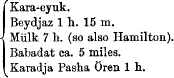
giving a total of 32¾ English miles (53 km.).

page 92 note 2 They are still less accurate in Von Diest's new map, here a reproduction of kiepert's. Compare note above.

page 92 note 3 Balik koyundji= ‘Shepherd's town,’ balik being an old word for ‘town’ which survives in numberless place-names. This is the name generally assigned, but the pronunciation we heard was distinctly Kuyumdji, and so Tchihatcheff and Hamilton have it. Kuyumdji =gold-or silver-smith. [We were told that the first element of the name was Bali which was said by our Greek servant to be, like Pali and Bavlo, a Turkish form of Paul, but this is doubtful. Pali in place-names generally = παλαιός.]

page 93 note 1 On this feature, see below under ‘Galatian Civilisation.’

page 93 note 2 So SirWilson, C.Handbook p. 18Google Scholar. We took 5 h. 20 m. going viā Aladja-atli.

page 93 note 3 Reckoned 6 hours, i.e. 18 miles; from Balik Koyundji to Beydjas is 6 hours according to Hamilton.

page 93 note 4 But no. (5) does not seem to belong to this road. It was found one hour to the south of Angora. See below, vii. §1.

page 94 note 1 This section was suggested to me by Prof. Ramsay.

page 94 note 2 So Kayser, Sauppe, Klotz, etc.

page 94 note 3 The castle beside Istanos is less probable. On Assarli-kaya compare Hamilton, i. p. 432: Perrot, , Exploration, pp. 215, 274Google Scholar.

page 94 note 4 Athen. Mitth. 1897, p. 1 ff. (espec. p. 19 ff.). We did not visit the site, but one obtains a fair view of it from the railway.

page 95 note 1 Hist. Geog. p. 31.

page 95 note 2 Haïmane (= ‘Waste’) is the modern name of the country south-west of Angora from the Sangarios well over to the Halys.

page 95 note 3 On Myrika, Hist. Geog. p. 226Google Scholar.

page 95 note 4 Cf. also Mnizos above, i. §5.

page 96 note 1 Possibly ᾿´Ανδρως ωνος is the name.

page 97 note 1 For another inscription of Ancyra, see no. 95.

page 98 note 1 There are tanning establishments by its banks in Angora.

page 99 note 1 Aus dem Stromgebiet des Qyzyl Irmak (Halys), Petermann's Mitth., Ergänzungsheft, no. 114.

page 99 note 2 Assi Yuzgat is about 37 km. (23 m.) from Angora.

page 100 note 1 Cf. Sir C. Wilson op. cit. p. 20.

page 100 note 2 Exploration, p. 279.

page 100 note 3 Hist. Geog. p. 254 ff.: see also under the various names.

page 101 note 1 ‘In the Table the stations are put in the reverse order, so that Corueunte is next to Archelais’ (Hist. Geog. p. 254).

page 101 note 2 Hist. Geog. p. 251.

page 101 note 3 As nearly as I can estimate; it is reckoned 4 hours by the villagers, but the hill has to be crossed.

page 102 note 1 Hist. Geog. p. 255, &c, He seems right in identifying with Gorbeous Constantine's Ἁκαρ κοῦς (error for Ἁκαρβοῦς, p. 216.

page 103 note 1 Noted by Prof. Ramsay, , H.G. p. 255Google Scholar.

page 103 note 2 Cf. Mr. Hogarth's excellent remarks à propos of the Caesareia-Melitene road in the article already quoted (R.G.S. Supp. Paper, iii. p. 42–3).

page 104 note 1 Reading 335° from the tchiftlik.

page 105 note 1 At the point where we left the valley to visit Avshar there is a cemetery with old stones (including some heavy columns). This point is 37 minutes from Avshar, 1 h. 44 m. from Tchidcmli, and reported to be 2 h. from Abbasli (which is 1 h. 22 m. from orsologia).

page 106 note 1 Shedit Hüyük reported 7 hours from Abbasli (our map shows 36 km.), which is 1 h. 22 m. from Orsologia, i.e. altogether about 42 or 43 kilometres (26 miles).

page 107 note 1 Gibbon, c. xxiv.

page 107 note 2 Hist. Geog. p. 298 f., 255.

page 108 note 1 The italicized g is used to signify that the letter is softened down in pronunciation so as to become almost silent.

page 108 note 2 The village is marked on our map as accurately as our materials permit. Kiepert's position is much too far west. It is 2–3 hours distant from Kotch Hissar and about 5 hours from Tchikin-aghil (the road has to curve round the mountain). The road to Parlassan from the north diverges from that leading to Tchikin-aghil at a point 1 h. 33 m. before reaching the former.

page 109 note 1 Two hours by road according to the villagers.

page 109 note 2 This road was described to us as going over Petchinek Ovassi [immediately south of Parlassan] and passing Kadyndjik, Fadilli, Devekowan, Kürimini, Sofular, Oïmagatch, Böjuk, and Kutchuk Bojalik (the last three under Ekedjik Dagh).

page 109 note 3 Pronounced Sariash (in Oberhummer's recent map wrongly named ‘Sari Yaghdschy’).

page 110 note 1 From Demirdji Tchikin-aghil reads 346°.

page 110 note 2 Hüyük and cyuk have the same meaning; but hūyük is the term used all over this country, while farther west eyuk is the ordinary word.

page 110 note 3 Cf. κατὰ ῥοῦν συγκατιοῦσα &c. quoted below.

page 111 note 1 Probably not going up to Eudoxias-Yürme (as supposed in H.G. p. 218, top), which lies high up off the road, but keeping lower down between Boz (Araït) Dagh and the Sangarios.

page 111 note 2 See my paper in Annual of the British School 1898, Part ii. § 2.

page 111 note 3 Hist, Geog. pp. 218, 227. First visited by Pevrot, M. (Exploration, p. 276Google Scholar).

page 114 note 1 Arch.-Epigr. Mitth. 1885, p. 131.

page 114 note 2 The misprints in the article, are due (the author informs me) to the fact that he received no proofs for revision.

page 115 note 1 We took compass readings to it from Herkenli (Dongdurma).

page 115 note 2 For the line of telegraphic stations, compare Histt. Geog. p. 352.

page 115 note 3 Compare the account of the Beacon and fortress on Dagh, Hassan in Hist. Geog p. 352–3Google Scholar.

page 117 note 1 Μνημεῖς ῾ Αγιολογικά p. 421.

page 117 note 2 Hist. Geog. p. 229.

page 117 note 3 Προσειλημενίται one MS.; προσελιμενίται three MSS. On this district see H. G. p. 251 and below § 3.

page 117 note 4 H. G., l.c.

page 117 note 5 This seems decisive against the suggestion expressed in Hist. Geog. p. 228 that Pitnissos was perhaps in the district Djihan-beyli near the Sangarios (with territory extending east to L. Tatta). There is only one fairly large site there (xi. § 6), and as it is near a splendid stream, it is ipso facto excluded.

page 125 note 1 This article contains the only complete account to be found of the formation of the province Galatia.

page 126 note 1 The continuation westwards is quoted below (xi. § 6).

page 126 note 2 So Mannert reads; but Verisso seems more probable.

page 126 note 3 There is another similar mound called Kara Tepe about one-and-half hours S. E.

page 126 note 4 In vii. as Γαλβάνου in viii. Γαλμάνων (a mere error).

page 126 note 5 The initial Ε might easily be slurred over and ultimately lost; Δ for Λ is a common error.

page 127 note 1 This pointed peak is very conspicuous. The fortress was examined by Mr. Crowfoot; I had fever at the time and could not accompany him.

page 130 note 1 I omitted to write down the name; but my recollection is distinct.

page 131 note 1 So in Notitia, iii.; otherwise ψίβηλα or ψίβιλα

page 131 note 2 Travels and Researches, p. 190.

page 132 note 1 Eighteen hours; which agrees with the map-measurement.

page 132 note 2 A good example is given in my second article on Phrygia, , J.H.S. 1898, p. 85–6Google Scholar.

page 132 note 3 Ptolemy places Kongoustos further west (cf. Hist. Geog. p. 361), in the same longitude as Laodiceia Katakekaumene, but Ptolemy's positions always require corroboration. Kiepert in his map in Franz's Fünf Inschriften a. fünf Städte alters the longitude of Laodiceia from ξβ to ξγ and places Kongoustos N. E. of it (as it ought to be according to our identification).

page 133 note 1 This is a mistake.

page 133 note 2 The place was visited by Dr. F. Sarre in 1895. When he says (Arch.-Epig. Mitth, 1896, 11. 34), Bei dem Dorf Tuzun, wo Ainsworth Ruinen fand und das alte Congustos vermuthet, haben wir keine antiken Rexte gesehen, he can only mean that he saw no stones there.

page 133 note 3 Dr. Sarre says again Hier (at Eski-il) fanden wir keine Spuren einer antiken Ansiedlung,— on which we may remark that he did not look all round and well about!

page 134 note 1 Kybele is mentioned in an inscription now at Suwarek (see the following number of the Journal).