Article contents
Finding history: the locational geography of Ashokan inscriptions in the Indian subcontinent
Published online by Cambridge University Press: 06 April 2016
Abstract

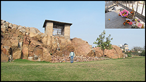
The Mauryan dynasty of the third century BC was the first to unite the greater part of the Indian subcontinent under a single ruler, yet its demographic geography remains largely uncertain. Here, the HYDE 3.1 database of past population and land-use is used to offer insights into key aspects of Mauryan political geography through the locational analysis of the Ashokan edicts, which are the first stone inscriptions known from the subcontinent and which constitute the first durable statement of Buddhist-inspired beliefs. The known distribution of rock and pillar edicts across the subcontinent can be combined with HYDE 3.1 to generate predictive models for the location of undiscovered examples and to investigate the relationship between political economy and religious activities in an early state.
- Type
- Research
- Information
- Copyright
- Copyright © Antiquity Publications Ltd, 2016
References
- 3
- Cited by


