


Introduction
The Qilian Mountains are located at the north-east edge of the Qinhai-Xizang Plateau (lat. 36°30'—39°30'N., long. 93°30'103°E.), between the dry Hexi region and the Alashan Plateau in the north and the Qaidam basin and the Yellow River valley in the south, 850 km in length, 200–300 km in width and about 200 000 km2 in area. About 30% of the whole mountain area is above 4000 m a.s.l.. Because of the high altitude and low air temperature, there are many glaciers in the Qilian Mountains. According to the statistics, there are 2859 glaciers with a total area of 1972.5 km2. The altitude of the snow line (north slope) rises westward from 4409 m in the east at Mount Leng Longling to 5075 m in the north-west Mount Qaidam. Also, the altitudes of the glacier termini rise from 4296 m in the east up to 5021 m in the north-west. The total amount of glacier-melt run-off per year in the Qilian Mountains is 11.56 × 10⁸ m3, of which 9.46 × 10⁸ m3 flows into the Hexi region, equal to 13.1% of the outlet surface run-off from the Qilian Mountains. In addition, there is a lot of seasonal snow cover in winter and spring in the Qilian Mountains providing snow-melt water; for example, the amount of snow-melt run-off in spring is as much as 7.64 × 10⁸ m3 in the Shiyang River, Heihe River, and Shule River areas, about 11.7% of total run-off. Based on preliminary investigations it is known that the surface-water resource in the Hexi region is 68.8 × 10⁸ m3, of which about 24.8% is from glacier and snow melting. The uneven distribution of water resources in space and time is the main problem in water supply, especially in the spring (April–June), and agricultural growth in the Hexi region is affected by a lack of water in the spring.
Because most of meteorological and hydrometric stations in the Qilian Mountains are distributed along the valleys at a low altitude, the data cannot be representative of information on precipitation and snow-cover in the high mountains. So, it is necessary to carry out snow-cover dynamic monitoring on a large scale and snow-melt run-off forecasting in that region using satellite remote-sensing technology. In this paper, the authors intend to discuss the characteristics of variation in the spring run-off in the Hexi region and their relation to snow cover in the Qilian Mountains, taking the Heihe River as an example, by using remote-sensing techniques.
1 Data, Methods and Accuracy of Estimations
NOAA/TIROS-N APT, AVHRR, and a few Landsat MSS cloud-free images in 1980–85 were used as the basic data. By optical interpretation techniques, the extent of snow cover in the Qilian Mountains was determined. Snow cover in satellite images was transferred on to a topographic map (1 : 150 000), using the Zoom Transfer Scope (ZTS); then the snow-cover area can be obtained by using a planimeter. Another method is as follows: snow cover in the satellite image was transferred on to a 1 : 100 000 scale topographic map, together with the elevation of the average seasonal snow line. The snow-cover area can be derived from an area-elevation curve for the Heihe River basin.
Bingou River, in the upper reaches of Heihe River was selected as a test basin for examining the dependability of snow-cover data derived from the methods mentioned above and for hydro-meteorological observations throughout the year, snow-cover surveys in the mountains and spectrum-reflectance measurement (0.38–1.20 μm) from different objects on the subaerial surface. The elevation of the seasonal snow-cover line in the Bingou River area on 3 November 1983 was 3900 m and the area of snow cover above this altitude was measured as 53.27 km2 from the topographic map (1 : 50 000), while it was 58.5 km2 in area from interpretation of NOAA/TIROS-N AVHRR images at 16.00 h on the same day. The value measured from images was 5.23 kms or 9.8% greater than that by observation. This method is economical and efficient, although it is less accurate. To measure the snow-cover area in a basin using NOAA/TIROS-N AVHRR digital data (CCTs), first of all, geometric correction of the AVHRR images must be carried out. Then, statistics of the snow-cover percentage can be obtained. Using this method, the position error is no more than 0.5 pixel. The NOAA/TIROS-N AVHRR digital data (CCTs) cannot be obtained within 24 h, although the accuracy is high, so it is not suitable for operational use.
2 Distribution of Snow Cover in the Qilian Mountains
Seasonal snow cover in the Qilian Mountains is formed in early September and ends in early June the following year, September to October and April to June the following year are the main supply periods of seasonal snow cover. Under the control of the Mongolian high pressure in winter, the Qilian Mountains are rather dry and cold, and with less precipitation. By interpreting Landsat MSS images on 7 and 8 October 1975, it is known that the altitude of the seasonal snow line in early winter in the eastern Qilian Mountains, including Heihe River and Shiyang River, is about 3800 m. Field observation shows that there is only fragmentary snow cover on shadow slopes and forest regions at an altitude of 3800 m in the upper reaches of the Heihe River in November. Between 3800 and 3900 m there is a discontinuous snow-cover zone; above 3900 m, there is a continuous (stable) snow-cover area, where the depth of snow cover reaches 5–20 cm. Based on an analysis of field-measurement data from 1983 to 1985 in the Bingou River test basin, within a certain range of altitude, snow depth increases with altitude, as follows:
where: D is snow depth (in cm), H is altitude (in m), ß is slope (in degrees).
The analysis of NOAA/TIROS-N, APT, and AVHRR images in recent years indicates that the snow-cover area in the Qilian Mountains decreases from the east to the west and there are two centres of snow cover: one is in Mount Leng Longling and the other is located between Hala Lake and Mount Danghe Nashan.
The beginning of the snow-melt season in the eastern part of the Qilian Mountains is on 5 April, according to data from the weather station there. When the mean daily air temperature is stable above 0°C, both the snow cover below an altitude of 3700 m and the river ice begin melting. In May, the 0°C isotherm of mean daily air temperature reaches an altitude of 4053 m and the snow cover melts rapidly. From April to early June is a period for both snow-cover accumulation and melting intensity.
All the seasonal snow cover melts in summer except in the area of the firn basin.
3 Characteristics of Spring Run-Off in the Main Rivers in Hexi Region
According to an analysis based on observations at 12 hydrometric stations on ten main rivers, the characteristics of spring run-off in the Hexi region can be described as follows:
-
(1) The amount of spring run-off in the Hexi region (excluding the Sugan Lake basin) is 12.18 × 10⁸ m3.
-
(2) The snow-melt run-off is 7.63 × 10⁸ m3, equal to 62.6% of the total amount of spring run-off. The values of snow-melt run-off in Shiyang River, Heihe River, and Shule River are 2.46 × 10⁸ m3, respectively. In addition, the proportion of snow-melt run-off to the amount of spring run-off decreases westward; for example, it is 72.8% for the Shiyang River basin in the east and 42.8% for the Shule River in the west.
-
(3) The major annual change in precipitation in the Qilian Mountains during winter and spring causes major annual variation in spring run-off. The average value of Cv for spring run-off in Shiyang River, Heihe River, and Shule River is 0.32, and the Cv value for snow-melt run-off in spring is 0.41, about three times as much as that of annual run-off in the Hexi region.
-
(4) Based on an analysis of square deviations and power spectra, it can be shown that there are several fluctuation periods such as 3, 8, and 15 years in Shiyang River, Heihe River, and Shule River, corresponding to variation in periods (years 3, 5, and 8) of precipitation from October to June in the Qilian Mountains. But the variations in spring run-off in the eastern part are not synchronous with those in the western part.
4 Prediction of Snow-Melt Run-Off
The spring run-off in the Hexi region is fed by the seasonal snow-melt water in the mountain areas, and secondly by ground water. The variation in spring run-off is determined by winter-spring snow-cover and air-temperature conditions in the Qilian Mountains (Fig.1). A prediction model of spring snow-melt run-off at the Ying Louxia Hydrometric Station (Heihe River) can be constructed by using hydro-meteorological data and snow-cover percentages for the Heihe River basin obtained from NOAA/TIROS-N APT, and AVHRR images.

Fig. 1 The relationship between snow cover in October and daily mean discharge from April to June at Yingluoxia hydrometric station.
(1) Daily model

where
-
n is dale series;
-
Tn is mean daily air temperature (°C) at the Qilian Weather Station on n day;
-
Pn is daily precipitation (mm) at the Qilian Weather: Station on n day;
-
Sn is snow-cover percentage in the Heihe River basin on n day
-
Qn+1 is mean daily discharge predicted on n+1 day;
-
Qnm is field-measured mean daily discharge on n day (m3/s);
-
Qnc is calculated discharge on n day (m3/s).
2 Prediction model for 2 days

where
Q0 is the mean daily base flow;
a0, a1, a2, a3 are coefficients;
Sn, Tn, Pn, Pn-1, Pn-2 are the same as mentioned above;
F(Tn) is the function of mean daily temperature;
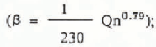
ß is the depletion coefficient of water
t is the term of prediction (2 d).
Equations (2) and (3) have been tested by the Water Resources Management Office of the Heihe River basin in the Zhangye and Flood Prevention Office of Gansu Province (Fig.2). The prediction accuracy is suitable for demands.

Fig. 2 Simulated versus measured stream flow at: Yingluoxia hydrometric station from April to May 1982.
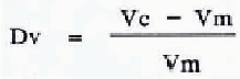
For an appraisal of the accuracy of Equations (2) and (3), a volume-error equation and a measure of model efficiency R2 have been used, as suggested by Reference Nash and SutcliffeJ.E. Nash and J.V. Sutcliffe (1970).
where
-
Dv is volume error (%);
-
Vm is measured amount of run-off;
-
Vc is calculated amount of run-off;

where
-
Qm is measured discharge (m3/s);
-
Qc is calculated discharge (m3/s);
-
Q is mean discharge measured during the prediction interval (m3/s).
Table I lists the values of Dv and R2 for Equations (2) and (3). For comparison, Dv and R2 from run-off simulations in several other basins are given in Table II. In this case, however, the daily flow for the rivers was computed from the snow-covered areas, temperatures, and precipitation, without corrections for the measured discharge. Therefore, the values of the accuracy criteria are not directly known.
Table I Accuracy of Snow-Melt Run-Off Forecasts from Equations (2) and (3)

Table II Accuracy of Snow-Melt Run-Off Forecasts in Various Countries*

Conclusion
It has been known that mountain snow cover in various climatic regions and at altitudes in the Qilian Mountains has different altitudes of the seasonal snow line and snow-melt conditions, due to variations in precipitation and the heat-exchange processes. Analyses presented here show that the glacier and snow-melt water in the Qilian Mountains is a very important part of the surface-water resource in the Hexi region and the development of agriculture in the Hexi region is strongly influenced by the snow-melt run-off from the Qilian Mountains in the spring.
This work suggests methods which may be used to forecast snow-melt run-off in any basin fed from the Qilian Mountains.
Acknowledgements
The authors gratefully acknowledge assistance from the Meteorological Bureau of Gansu Province in supplying NOAA/TIROS-N APT, and AVHRR images, and from Qiu Guoqing and Mrs Yang Zhenniang for their valuable advice.


