
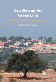

The Settlements along the Trans-Israel Highway
For a fee of 34 new Israeli shekels one can enjoy a private car ride along the entire 200 km of the Trans-Israel Highway and witness the ever-increasing construction boom that has turned the area from a frontier zone into a blooming real-estate market. Built in the early 2000s, the new, privately funded four-lane motorway presents the local driver with an uninterrupted journey at an average speed of 130 km per hour, bypassing the heavily crowded Tel Aviv metropolis all the way into the third millennium. Driving along the highway, one might forget that it runs parallel to the official border between the State of Israel and the Palestinian West Bank, the Green Line, which was successfully blurred by the extensive development of Israeli settlements on both of sides. Looking closely at the well-maintained landscape, the attentive driver might easily recognize shimmers of the West Bank Separation Barrier that was built east of the official border and surrounds the Palestinian cities of the Occupied Territories, despite efforts to hide it. The overt private highway and the covert state-constructed barrier constitute a mutually rewarding relationship, where the former contributes to the interests of the latter and vice versa.
This book attempts to understand the nature of this mutually rewarding relationship and how it shapes the local built environment. It has its feet in political economy, yet it is written from the perspective of architectural and urban planning history. Correspondingly, while architecture and planning are the subjects of this book, it uses political economic analyses as a perspective to understand how they are formed. Therefore, the book focuses on the production process, rather than the product, using the Israeli settlement mechanism as its object of research in order to understand the built environment it produced. This mechanism is part of a century-long process that began with the first waves of Zionist immigration to Palestine in the late 1800s, intensified during the British Mandate and continued to form official policy even after the establishment of the State of Israel in 1948. Consequently, it forms an integral part of the spiritual and physical Jewish national revival and constitutes a leading case study of a state-led geopolitical process of spatial development. With the global neoliberal turn during the 1970s and the liberalization of the local economy, the state began to privatize its settlement project, merging individualistic interests and speculations with geopolitical considerations.
This book claims that the increasing privatization of the settlement mechanism since the late 1970s is the result of a state-directed effort to facilitate its continuation by harnessing it to the logic of the market, leading to a coalition of national and private interests that dictate the formation of the local built environment in an evolving process of privatize and rule.Footnote 1 I focus on settlements constructed on both sides of the Green Line that are located between the Trans-Israel Highway built in 2002 and the West Bank Separation Barrier erected in 2006. The metamorphosis of this former frontier area was enabled by intense state-led development efforts following the occupation of the Palestinian territories in 1967 and the election of the first right-wing and economically liberal government a decade later. This process relied on the growing involvement of the private sector, marked by the first privatized national infrastructure project – the new cross-country motorway, also known as Highway 6.
Embracing the term settlements along the Trans-Israel Highway, which was used by the state more than a decade before the road’s paving even began,Footnote 2 I emphasize the connection between the privatized highway and the territorial settlements around it. It therefore highlights the use of the seemingly neutral façade of private development to blur the Green Line and to facilitate Israel’s eastward expansion into the West Bank. There is rarely any physical connection between the settlements and the highway, which is a national arterial road and thus consists of minimal intersections. Yet, it is these settlements that incorporated the area into Israel’s main metropolitan region and enabled the highway’s construction. Simultaneously, they also enabled the erection of the West Bank Separation Barrier several kilometers east of the Green Line, de facto annexing parts of the Occupied Territories.
This book shows that the settlements along the Trans-Israel Highway are an outcome of evolving modes of privatized spatial production, which relied on a system of spatial privileges and have produced different housing typologies over the past four decades. These modes of production are based on the state granting favored groups of individuals, developers, and entrepreneurs the ability to influence the formation of built space as a means to continuously develop and settle national frontiers. The settlements along the Trans-Israel Highway therefore constitute a unique case study of the relationship between the political interest to control space and the ability to carry it out.
Analyzing these modes of production, the spatial privileges they relied on, and the housing typologies they produced, I examine how the state incorporated a variety of private groups into its territorial project, ensuring its continuation while transforming the local built environment. Thus, unlike the research perspective that sees privatization as a state-led effort to ensure the survival of capitalism, privatize and rule depicts a contrary scenario, functioning as an economic means to a geopolitical end. Accordingly, this book challenges the conception of the built environment as a cultural product, as it sheds light on the ability of political and economic agendas to dictate the production of space – drawing a continuous line from the strategic regional level, through urban planning and design, all the way to the architecture of the single dwelling unit.
Book Focus
As an outcome of a privatized geopolitical project, the settlements between the Trans-Israel Highway and the West Bank Separation Barrier are a servant of several masters. Accordingly, this book claims that as the state was interested in expanding its power over space, it granted select groups spatial privileges that included the power to inhabit, plan, and construct it. Therefore, the production of these settlements followed the different functions they were meant to serve. First, the national-territorial aspect of controlling space dictates the location and spread of new settling points and in strategic plans appears as dots or continuous ink stains. Second, the individual and speculative interests of the different private groups that the state has involved in its territorial project since the late 1970s dictate the manner in which each ink stain is materialized. The book also claims that with the changes in local economic, political, and cultural values, the nature of these select groups altered, and with it the spatial privileges they received, thus creating a series of evolving modes of spatial production that transformed the local architectural and urban products accordingly. I first identify the changing geopolitical, individual, and corporate considerations that form the basis of the evolving modes of production. Then, I analyze the spatial manifestation of each mode of production, thus identifying the architectural and urban components that define the privatized Israeli national project. I examine how the development of Israeli settlements on both sides of the Green Line has evolved since 1977, in line with transforming national economic and geopolitical agendas, and how these were manifested in the settlements’ architectural and urban form.
This book focuses on the border area with the West Bank since 1977, as both the location and period signify the privatization and financialization of the Israeli economy and the expansion of the national settlement enterprise. This area was only sporadically settled by the state during the 1950s and 1960s, as it preferred to develop other national frontiers.Footnote 3 With the occupation of the West Bank in 1967 and the election of the first right-wing and pro-laissez-faire government in 1977, the geopolitical status of the area became a leading national interest, while its relative proximity to the Tel Aviv metropolis gave it the potential to satisfy personal desires and economic speculations.Footnote 4 Located on the fringes of the West Bank, it was ideological enough to become an area of national importance, yet not too ideological like the depths of the Occupied Territories, and thus appealed to almost all sectors of Israeli (Jewish) society.Footnote 5 Correspondingly, it turned into a platform for one of the most intense development processes, which, in less than twenty years, concluded in the construction of over thirty new localities. As an extension of the Tel Aviv metropolis, these new settlements attracted thousands of upper-middle-class families with strong affiliations to the secular and centre-left political sector, giving the territorial project a seemingly apolitical and neutral mask.
Developed by a coalition of geopolitical, personal, and financial objectives, the settlements on both sides of the Green Line represent the privatization of the Israeli national geopolitical project. The construction of the adjacent cross-country highway in the early 2000s, the first privately built and operated road in Israel, further emphasizes the role of both privatization and geopolitics – creating a geographical unit of privatized national projects. Focusing on the manner in which the development mechanism was privatized and the different settlement typologies it produced, this book shows how the location, urban fabric, and architecture of the houses corresponds with national territorial aspirations, private interests, and profitability concerns.
To explain how the settlements along the Trans-Israel Highway took shape, I focus on four different development phases, each with its specific modes of production and unique settlement phenomenon. First is the neo-rural development of the late 1970s, which was based on young urban families seeking a pioneer-like experience in the national frontiers and the small-scale Community Settlements they established. Second is the gentrification of the Green Line and the new Suburban Settlements that housed the Israeli upper-middle-class during the 1980s, in its quest for detached private houses within commuting distance from Tel Aviv. Third is the mass suburbanization of the 1990s, which witnessed the increasing involvement of private developers, leading to reproduced and high-rise residential environments. Finally, the current financialization phase and its speculative projects promotes the construction of corporate-led settlements, suburban in terms of everyday life, yet urban in terms of scale.
Political Historiography of (Israeli) Architecture and Urban Planning
The built environment is the human-made space in which we conduct our everyday lives. This consists of the buildings, streets, infrastructure, and nonnatural landscapes that surround them. Being a cultural artifact, the built environment reflects the social context in which it was produced. Therefore, in a basic Marxist analysis, the built environment would be part of the superstructure, shaped by the base that consists of the means and relations of production.Footnote 6 Expanding this analysis, Adorno and Horkheimer, in their writings on the Dialectic of Enlightenment, coined the term culture industry, classifying culture as an integral part of the means of production and the base that produces the societal superstructure.Footnote 7 Correspondingly, Lefebvre, in his analyses of built space, claimed that it is not a mere reflection of the existing social order but rather an integral part it, ensuring its continuation while functioning as “a means of production” and also as “a means of control, and hence of domination.”Footnote 8 While most Marxist and neo-Marxist theoreticians focused on economic classes, Gramsci introduced the concept of hegemony, the ruling social class, to explain additional ruling interests and values that go beyond the simple economic rationale, such as nationalism, conservatism, and orthodoxy. The influence of the ruling class, according to Gramsci, is rendered in the built environment, as it controls “everything which influences or is able to influence public opinion, directly or indirectly … even architecture, and the layout and names of the streets.”Footnote 9 However, whether the built environment is produced by the social order or whether it reproduces it, they both correlate one to the other and as the means and relations of production are constantly changing, the ruling hegemonic values change in harmony. Respectively, their spatial manifestations are supposed to transform as well. Thus, by studying the planning history of a given place – in the case of this book, Israel – we are able to understand the prominent political, economic, and cultural values that dictated the formation of the built environment and how they changed over the years.Footnote 10
The existing scholarship on the politics of built space is vast and multifaceted. Nevertheless, it is possible to identify several leading approaches that characterize the main research perspectives, which analyze the way the power of the state is both reproduced and represented in the built environment. The representational perspective focuses on the manner architecture “symbolises,” “expresses,” “houses,” or “displays” the power of the state.Footnote 11 Accordingly, the focal point of this approach is primarily iconic governmental buildings or national compounds,Footnote 12 usually of totalitarian regimes such as Nazi Germany, the USSR, or Fascist Italy, whose aesthetics are supposed to idealize the state and thus legitimize and enforce its rule.Footnote 13 Besides the common attention to fascist aesthetics, other researchers also considered democratic regimes, like the metaphoric aspects of transparency in West Germany,Footnote 14 or the adoption of Bauhaus architects by the American establishment as part of its efforts to depict the USA as the protector of democracy and freedom.Footnote 15 Similarly, at the urban level, Lawrence Vale’s analyses of capital cities focus on the manner in which they were used to emphasize the authority of the state and its dominant culture.Footnote 16 Alternatively, James Holston and James Scott analyze capitals as a state-led social engineering process, intended to enforce certain behavior and modes of everyday life that confirm the ruling sociopolitical order.Footnote 17 Here, the focus is more on the built environment’s ability to reproduce the existing power relations and less on its representational capacities.
The emphasis on spatial practices, rather than representation, originates from social studies theories in the 1960s and 1970s and the “spatial turn.”Footnote 18 Whether in Pierre Bourdieu’s concept of habitus and the divisions and hierarchies that create a common ideological construct,Footnote 19 Anthony Giddens’ analyses of privacy and rules as spatial domination structures,Footnote 20 Michel Foucault’s study of space’s disciplinary power,Footnote 21 they all focused on the dominance mechanism produced through built space as an attempt to subjugate the individual to the rule of the state. The innovation and popularity of this social perspective led to a vast architectural and planning history research that is based on the theories of the scholars mentioned above, as well as on other similar approaches.Footnote 22
At the same time, as stated by architectural and urban critic Kim Dovey, the spatial adaption of the social sciences perspective usually diminishes the role of individuals, considering them solely as subjects, rather than agents. He therefore suggests a pluralistic approach that considers them as both, with the ability to be “empowered” and “disempowered” by the built environment.Footnote 23 Drawing on the work of Jeffrey Isaac,Footnote 24 Dovey emphasizes the difference between power over, the ability to harness the capacities of others to one’s interests, and power to, “[t]he ‘capacity’ to imagine, construct and inhabit a better built environment.”Footnote 25 Applying this distinction to the development of Israeli settlements, we could easily claim that this was a process in which the state enhanced its power over space by providing its citizens with housing opportunities in frontier areas. Accordingly, this was a state-led social engineering project, which created a spiritual bond between the citizens and the state while securing its legitimacy and territorial rule; using built space to control citizens on the one hand, and using citizens to control space on the other.
Allegedly, the privatization of housing development is a process with the potential to turn the individual from a mere subject into an agent. By transferring the responsibility from the state to the individual, the latter is granted the power to inhabit, plan, and create the built environment. Lisa Findley highlights the role of architecture as a liberating tool for subjected people, confirming their participation in cultural production. She refers to Le Corbusier’s contention that “taking possession of space is the first gesture of living things” and that “the occupation of space is the first proof of existence.”Footnote 26 In this sense, the power to occupy space is seen as an essential component of individual liberty that turns one into a spatial agent.Footnote 27 Similarly, the neoliberal order, which shifts the focus from the state’s role as provider to that of enabler, adopts the same discourse of individuals as agents. At the same time, as David Harvey shows, neoliberal economies that claim to reduce state involvement eventually conclude in major “special interventions,” meant to encourage “ ’[a] good business or investment climate’ for capitalistic endeavours.”Footnote 28 Ultimately, this limits the individual’s power to affect the formation of the built environment while harnessing their interests to those of the market.Footnote 29 Nevertheless, while Marxist geographical analyses usually depict geopolitics as means serving capitalist objectives,Footnote 30 complex ethno-territorial contexts, like Israel, usually present an opposing scenario.
Superficially, a privatized national settlement project seems an oxymoron, as individual interests usually contradict those of the state. In his analysis of architectural production, Charles Jencks depicts three separate systems, private, public, and corporate, all of which have their own motivation – usage, budget, and profit, respectively.Footnote 31 Nevertheless, Jencks does not mention the ideological or political incentives of the state. Most importantly, he ignores the fact that it is the state that enables the private and corporate systems to operate, and that their produced architecture is thus subject to the state’s interests as well, especially in a case like Israel.
To analyze the evolving modes of production and the role private agents began to play in them, I use the term spatial privileges. The term is usually used to describe the advantages members of a hegemonic group enjoy within the built environment,Footnote 32 whether this is due to race, ethnicity, gender, or social class.Footnote 33 Thus, it is an integral part of Logan and Molotch’s “place stratification model,”Footnote 34 which describes the ability of privileged groups to manipulate the production of space for their own socioeconomic benefit.Footnote 35 Re-explaining the model, Logan defines “spatial privilege” as the objective of hegemonic groups seeking segregation, eventually creating a “rigid hierarchy of places.”Footnote 36 However, in this book, I use the term to describe the exclusive rights members of favorable groups receive from the state as a means to incorporate them into the national geopolitical project with the purpose of ensuring its continuation and constantly recreating the hierarchy of places. Returning to Dovey’s analysis, these spatial privileges are an outcome of a quid pro quo relationship that is based on granting favored groups the power to plan, construct, and colonize space, as a means to enforce the state’s power over it. Therefore, in the privatization of a geopolitical project, it is by enabling (select) groups and corporations to participate in the production of new settlements that the state is capable of domesticating its frontiers.Footnote 37
Ethnically oriented, the State of Israel granted spatial privileges to specific socioeconomic groups that could ensure the geopolitical objectives of its territorial project and the evolving economic rationale behind it. Haim Yacobi and Erez Tzfadia refer to this process as “selective privatisation,” as the Israeli Government granted substantial spatial rights to “selected elites” in order to promote the settlement of its national frontiers and to expand its territorial control.Footnote 38 This selective privatisation is precisely a case of Harvey’s special interventions, intended to produce a certain economic climate and, subsequently, create a unique coalition of private, corporate, and national interests, which changed along with transformations in the Israeli economy, politics, and culture.
The privatization of Israel is a long and meandering process that benefited different social groups in various ways. The global decline of the welfare-state approach, which began in the late 1960s and early 1970s, affected the Israeli economy as well, and the government promoted more liberal approaches instead. This ignited a process of privatization that intensified throughout the 1970s and 1980s, concluding in the comprehensive reorganization of state-led projects, including the development of new settlements and housing estates. The state continued to act as the initial planner and initiator of these projects as it still controlled more than 90 percent of available land; its construction and marketing, however, were conducted by private individuals, associations, corporations, and entrepreneurs,Footnote 39 consequently privatizing the Israeli project. Subsequently, the reciprocal relations between the state’s power over and the private power to transformed, leading to new modes of production that relied on granting diverse spatial privileges to various select groups.
The fact that it was developed by a coalition of individual, corporate, and national interests makes the Israeli settlement project a unique case of privatization and thus an exceptional case study of the influence of political–economic interests on the production of the built environment. To understand the politicization of housing under a privatized economy, we will consider seemingly mundane, ordinary, and banal housing projects. These, unlike iconic public or commercial buildings that are usually the focal point in the research on politics, economy, and architecture, constitute the vast majority of the built environment while shaping the everyday lives of the individuals who live in them,Footnote 40 thus forming the ultimate research object in the study of the relationship between state, individual, and spatial production processes.
This book considers the role of the built environment in the national geopolitical project while focusing on its production, instead of its architectural and urban products. Similar to Rafi Segal and Eyal Weizman’s A Civilian Occupation, it discusses how architecture and planning became part of the national territorial agenda. At the same time, focusing on production, I aim to avoid possible oversimplifications. For example, Segal and Weizman cite a 1984 report by the Ministry of Construction and Housing, which recommended orienting the living rooms in settlements toward an open view. Relying on Paul Virilio, they explain that this was intended to create a “network of observations,” which would control the local Palestinian population.Footnote 41 In Hollow Land, Weizman repeats this analysis again, mentioning the Hebrew term “Mitzpe” (lookout) that is used to refer to a new settling point.Footnote 42 Nevertheless, as the same guidelines had already been published in 1982 by the Jewish Agency’s (JA) Settlement Division, in a document with clear instructions on how to increase “quality of life” in mountainous sites,Footnote 43 the desire to provide each household with an open panorama constitutes a more reasonable explanation than Weizman’s panoptic analysis. Thus, the Hebrew translation of Hollow Land was mockingly criticized in the right-wing national-religious Makor Rishon newspaper. Concentrating specifically on this issue, the review claimed that the book was based on unsupported political statements, and that “in the twisted world of the extreme left, every settler is a spy.”Footnote 44 Schnabel, the reporter who wrote the review, was not horrified by the territorial role attached to settlements, which he clearly supports and believes in, but rather by the claim that the architecture of the houses relied on militaristic principles.
To understand the geopolitical role of the built environment this book considers it as the product of the settlement mechanism. Compatibly, the JA’s plan for the West Bank spoke of “settlement tools,”Footnote 45 which are the different incentives used to attract people to the Occupied Territories; these include grants, subsidies, real-estate speculations, and social seclusion. Built space was not, therefore, a settlement tool meant to attract settlers or to function as a reconnaissance device, but rather an outcome of the various policies that were intended to stimulate the development of new settlements. This book thus discusses the settlement mechanism, which is the coalition between the state, the various agents it used, and the spatial privileges they were granted. To understand how the settlement mechanism works, I concentrate on the gradual changes it went through, examining the evolving modes of production it relied on and analyzing how these transformed the local built environment. With the focus on production, rather than the product, this book deliberately ignores the role of architects and planners as the masterminds of the production of built space, referring to them as mere executors of the settlement mechanism. Furthermore, comparing case studies on both sides of the Green Line, I show that the new modes of production were enacted both in the pre-1967 borders and in the Occupied Territories, thus highlighting the efficiency of privatized territoriality and its ability to blur the former border.
Most of the current literature focuses on ideological and political aspects, while relatively neglecting the economic standpoint. At the same time, scholars who focus on the privatization of Israel usually do not deal with its spatial urban and architectural morphology. Accordingly, the focal points are frequently politically contested case studies like the West Bank, as in the varied works of Weizman, Segal, Newman, Cahaner, Allegra, and many others;Footnote 46 or ethnically divided cities, former Palestinian neighborhoods, and peripheral towns inside Israel, such as the studies of Pullan, Yiftachel, Nitzan-Shiftan, Yacobi, Tzfadia, and Jabaraeen.Footnote 47 While they all discuss the political agenda in detail, the link with political-economics is quite preliminary, including several papers such as Yacobi and Tzfadia’s “Neo-Settler Colonialism,” Gutwein’s concept of “alternative welfare state,” and Yiftachel and Avni’s short introduction in “Privati-nation.”
Moreover, the existing literature usually studies the regional and urban levels, creating a research gap at the architectural level that would draw a continuous line from the national to the individual scale. Efrat’s groundbreaking work The Israeli Project and Allweil’s brilliant Homeland are in fact written from an architectural and regional perspective.Footnote 48 Yet, they mainly focus on the nation-building process, discussing its representational and social engineering roles, and thus do not address territorial, individual, and corporate interests post-1977. Researchers that have dealt with the architecture of settlements over the past four decades analyze it as an attempt to normalize occupation through banal and aesthetic spatial practices.Footnote 49 This book, however, takes a contrary position, claiming that architecture is the product of privatization and normalization, rather than their producer. It focuses on settlements on both sides of the Green Line, a comparison that is usually avoided, showing that despite the differing legal status, these settlements relied on the same modes of production and thus consisted of the same architectural and urban characteristics.
The case studies examined in this book represent the increasing privatization of the settlement mechanism and its evolving modes of production (Figure 1.1). Sal’it, the Reihan Bloc, Nirit, and Ya’arit demonstrate the early privatization measures of the late 1970s, which were based on granting small homogeneous groups the right to form an exclusive Community Settlement. Kochav Yair, Alfei Menashe, Oranit, and Reut, represent the mid-1980s, when privileged groups of well-connected private associations and private developers were granted the right to develop and/or populate a new Suburban Settlement. Bat Heffer, Tzoran, Tzur Yigal, Matan, Lapid, El’ad, and Tzur Yitzhak represent the mass suburbanization of the 1990s and the shift to private corporations, while Harish, the last case study, illustrates the current finance-led development that is based on the power to speculate as the main feature in the settlement mechanism.

To understand the development mechanism behind the production of these case studies, we will rely on different types of primary and secondary resources. These include meeting protocols, correspondences, ministerial reports, aerial photos, maps, national strategic plans, urban outline schemes, architectural drawings, photographs, and historical news articles. These sources also include relevant statistical information on the population and the development process and combine interviews with key figures and documentation of the settlements’ current situation. To analyze the mutual geopolitical, individual, and corporate interests, I first examine each case study at the strategic level – analyzing its location along the Green Line, and its size and affinity to other existing Jewish and Arab towns, while considering the state’s incentive to increase its power over this specific space. Then, identifying the relevant spatial agents, their interests and desires in correspondence with the spatial privileges they were granted, we will analyze each new mode of production and the way it matched the state’s geopolitical agenda.
Subsequently, to understand the spatial manifestation of each mode of production, we will analyze each case study from its urban outline to the layout of the single dwelling unit – starting from the street system, its arrangement and hierarchy, moving to the zoning and distribution of public and private functions, as well as the sites’ gross and net density. We will then examine the residential buildings’ sizes, height, volume, and envelope, as well as the composition and distribution of dwelling units, their inner layout and relationship with the buildings’ envelope, explaining how architectural and urban products are an outcome of the settlement mechanism.
Outline
This chapter has introduced the main features of the book. Following on from this, Chapter 2 provides the historical and theoretical context to the development of the settlements along the Trans-Israel Highway. It starts by identifying the geopolitical role of settlements in Israel/Palestine and how they relied on evolving modes of territoriality. Relying on key theories on the welfare nation-state and the global turn toward neoliberalism and the market economy, the chapter presents the Israeli version of the phenomenon and how it led to a new mode of territoriality that was based on privatized modes of spatial production. Illustrating the entangled relations between nationalism, territoriality, and privatization this chapter clarifies the complexity of the subject and explains its unique profile. Presenting a general view of the development mechanism of the settlements along the Trans-Israel Highway, on both sides of the Green Line, the chapter prepares the reader for those that follow, explaining what makes the area a privately developed national project.
Each of the following chapters focuses on a singular frontier domestication mechanism and the new modes of privatized spatial production it relied on. Accordingly, each chapter examines different select groups that enjoy particular spatial privileges, or powers to produce built space, as a means to secure and expand power over it, thus generating specific settlement phenomena that correspond with the enacted mode of spatial production.
Chapter 3 focuses on the neo-ruralization of the frontier, which constituted the first privatized mode of spatial production and formed a new phase in the domestication of the Green Line. Accordingly, it deals with the Community Settlements – small-scale nonagricultural villages that consist of a limited number of families and a relatively homogeneous character. These were first used by the Israeli Government and its various planning agencies during the 1970s in order to attract city dwellers to frontier areas by offering them a pioneer-like experience, granting them the power to form their own secluded ex-urban communities while strengthening the state’s power over areas of national interest. This chapter examines six different settlements that were initiated during 1977–81 on both sides of the Green Line and constitute the first example of early privatization. These include Sal’it, Reihan, Shaked, Hinanit, Nirit, and Ya’arit. Analyzing the development of these six case studies, and how they changed over the years, the chapter shows how the neo-rural experience and the concept of community became the leading force behind the national territorial project in the early 1980s, forming a new mode of spatial production. In examining the shift toward the individual during the 1990s and the growing emphasis on corporate interests in the early 2000s, the chapter illustrates how this mode of production continued to evolve, relying on new spatial privileges and producing new housing typologies.
Chapter 4 deals with the gentrification of the Green Line, a state-led effort to attract upper-middle-class families to settle the area. Accordingly, it focuses on the Suburban Settlement – a spatial phenomenon of the early 1980s that offered the option of spacious houses in a homogeneous commuter community that suited the desires of the newly forming bourgeois class. Focusing on this new settlement mechanism, this chapter illustrates how the power to develop space became a privilege given to upper-middle-class families and contractors the state wanted to attract to the area, thus gentrifying the former frontier and eventually enabling its further domestication. The chapter considers the first Suburban Settlements established along the Green Line, Kochav Yair, Alfei Menashe, Oranit, and Reut. Analyzing the new mode of spatial production and examining the (sub)urban and architectural typologies it produced, the chapter illustrates how changes in the settlement development mechanism led to alterations in housing practices and transformed the local built environment. Moreover, it shows how the emerging upper-middle-class was able to promote its own segregated suburban communities, and how the state used the suburban aspirations of this class to incorporate the former frontier into the main metropolitan area.
Chapter 5 considers the mass suburbanization of the 1990s, which formed a new mode of production that relied on the unprecedented involvement of the private sector. Unlike earlier examples, where the construction of new settlements was a collaboration between national institutions, settling movements, and small-scale private initiatives, by the early 1990s the state moved the process forward into the hands of large-scale private developers. This resulted in the mega suburbs of the 1990s – mass-produced residential environments consisting of tract housing developments and repetitive architectural typologies. The chapter focuses on the ‘Stars’ settlements – seven new sites initiated by the state in the early 1990s that demonstrate the completion of the transition into a privatized national project. Analyzing the architectural and urban characteristics of these new settlements, as well as their development mechanism, location, and intended target population, the chapter provides additional insight into the changing relationship between the private power to and the state’s power over space.
Chapter 6 focuses on the financialization of the Green Line, which derived from increasing attempts to develop frontier settlements by creating a real-estate market and relying on the speculative interests of entrepreneurs and investors. This chapter considers the case of Harish, a project that different governments unsuccessfully tried to develop over the last forty years. Its peripheral location and proximity to the West Bank and other Arab towns, on the one hand, and the lack of interest in rural settlement, on the other, repeatedly prevented the site’s development. By 2010, the widespread demand for new dwelling units, the construction of the Trans-Israel Highway and the newly built West Bank Separation Barrier all contributed to turning Harish into an attractive piece of real estate, enabling the Israeli Government to designate it as a city with a target population of 60,000. While focusing on the case of Harish, the chapter analyzes the new financialized mode of production and illustrates how the power to invest, speculate, and develop real estate became the main tool in the national geopolitical campaign. By analyzing the urban layout and housing units in Harish, the chapter explains how this future city corresponds with the new mode of production and forms the pinnacle in the privatization of the national settlement project, embodying the manner in which architecture turned into a mere product of economic speculation.
Chapter 7 discusses the book’s main findings. It draws a continuous line between the different modes of production and settlement phenomena presented in the previous chapters and explains how they constitute a gradual process of privatization. It summarizes the various national and private interests in the development of the area along the Trans-Israel Highway and explains how this influence was manifested in the local built environment and everyday civilian life. Reviewing the case studies presented in the book, the chapter concludes with insights that explain the relations between nationalism and neoliberalism, considering how the local materialization of this coalition presents a unique example with global significance that goes beyond the context discussed here.

